 Aspetto
Seabed maps
The seabed, sharp
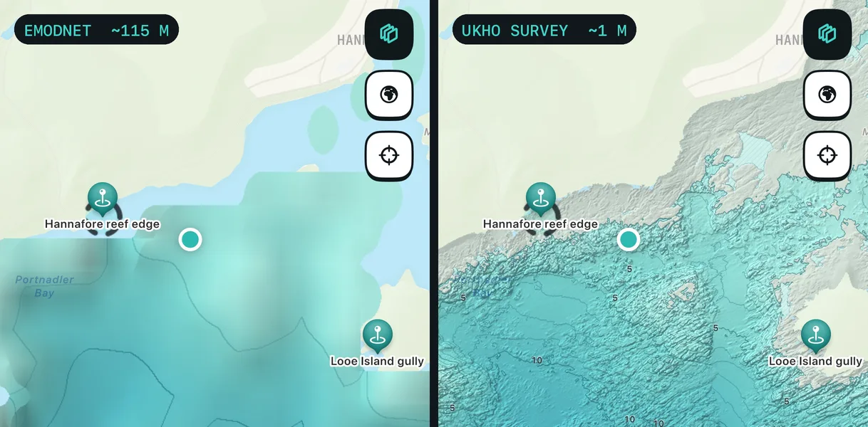
The detail spearfishers care about (a reef edge, a gully, a patch of sand between rocks) is smaller than most charts can show. Aspetto uses survey data fine enough to see it.
Where the data comes from
Real surveys, shaded
- UKHO multibeam surveys at about 1–2 m, from the ADMIRALTY Seabed Mapping Service, for Dodman Point to Whitsand Bay.
- Drying ledges from Environment Agency LiDAR, so rock and sand that uncover at low water show up too.
- Close inshore, where no survey reaches, a clearly marked estimate: paler, hatched and never used for suggestions.
- Everywhere else, EMODnet Bathymetry at about 115 m, so you still get the shape of the ground.
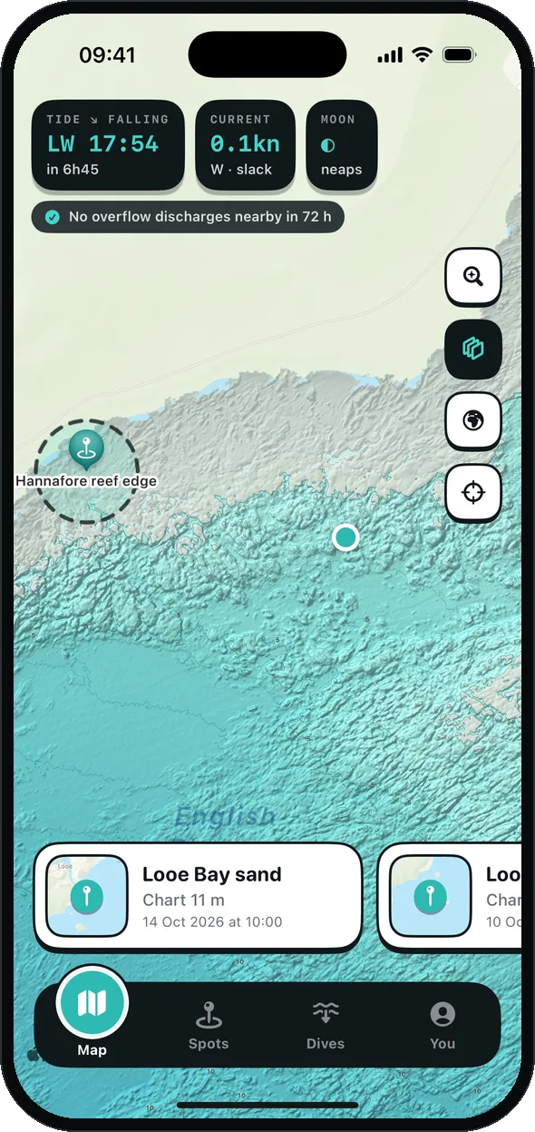
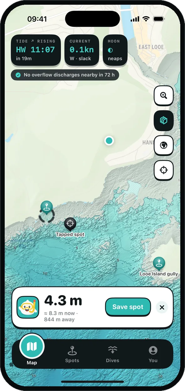
Hill shading picks out the texture, and contours go down to every metre when you zoom in. Tap anywhere for the depth, where it comes from ("UKHO survey", "estimate, not surveyed") and the depth now with the tide.
Bottom type
Rock, sand or seagrass
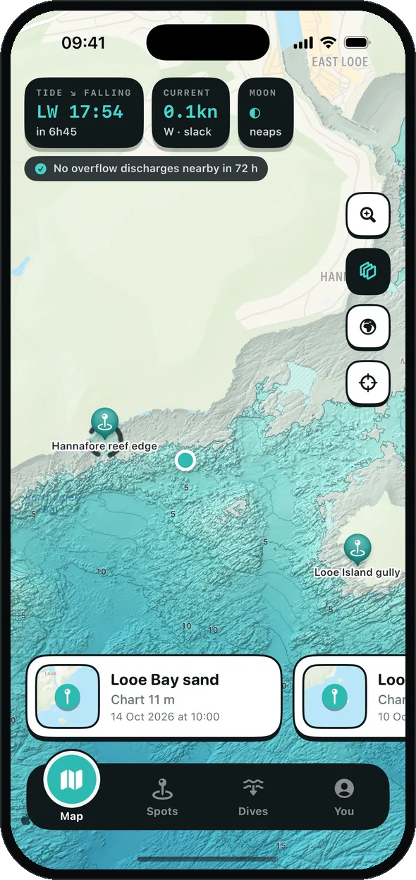
Round Looe and Fowey, a Bottom layer tints the map by what the seabed is made of: rock, boulders, gravel, sand, mud or seagrass. It comes from survey backscatter, the survey's own sediment map and Natural England's seagrass layer. Measured patches are stronger; inferred ones are paler.
Suggestions use it too, so a "sand flat" on known rock is dropped.
Offline, on your wrist
The seabed under you
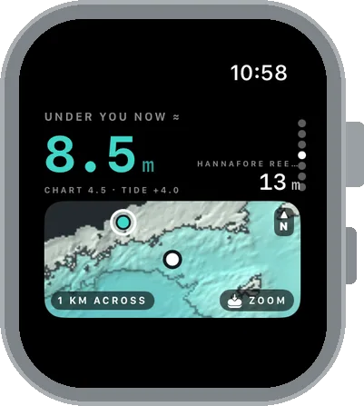
Before a session, the iPhone sends the survey tiles round you and your spots to the watch. In the water the watch's Seabed page shows a small map and the charted depth under you, adjusted for the tide, with no signal needed.
More areas
Cornwall first. Then the UK.
The detailed surveys cover Dodman Point to Whitsand Bay today. The map is built to take more: each new survey is added as tiles, with no app update. Tell us where you dive and we'll know where to go next.
Join the beta and tell us